Location: 41.81724°N 71.44249°W
Get Directions
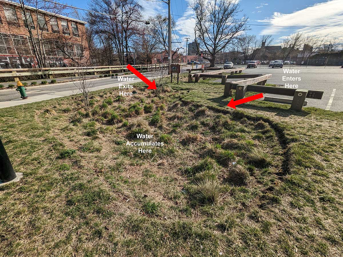
Site Description: This site is an infiltration basin located in the Olneyville neighborhood of Providence behind the Mi Ranchito restaurant along San Souci Drive, and is operated and maintained by the Woonasquatucket River Watershed Council. The basin fills with stormwater during rain events and is planted with beautiful native grasses and plants. Stormwater enters the site on the northern end of the parking lot via a grass filter strip. Inside the basin, the soil, grass, and plants act as a filtering mechanism to clean pollutants from the stormwater as it drains into the ground. When the system reaches full capacity, excess stormwater flows out through the overflow structure located within the basin. The captured stormwater should absorb into the soil within 24-48 hours after a rainstorm.
Photo-Video Tips: Stand near the northern edge of the parking lot to capture video of stormwater flowing into the basin through the grass filter strip. Also, document with video that the basin is filling up and draining properly.
Observation on 9/13/2023: 1:18pm -
How recently did it rain: Raining at the time
How heavy was that rain: Moderate Rain
Is anything preventing water from flowing into the system (e.g., debris, trash, vegetation): Partially
Is there standing water in the system: Yes
Notes/Comments:
Standing water in the vegetation area. Standing water against the street curb and partial vegetation on the sewer drains.
Observation on 9/10/2023: 7:01pm -
How recently did it rain: 1-3 hours ago
How heavy was that rain: Heavy Rain
Is anything preventing water from flowing into the system (e.g., debris, trash, vegetation): No
Is there standing water in the system: Yes
Notes/Comments:
Heavy vegetation in this area and water within the vegetation. Drain on street is covered with vegetation and standing water on street
Observation on 7/10/2023: 12:35pm -
How recently did it rain: Raining at the time
How heavy was that rain: Heavy Rain
Is anything preventing water from flowing into the system (e.g., debris, trash, vegetation): Partially
Is there standing water in the system: Yes
Notes/Comments:
Not all runoff from the parking lot and surrounding impervious surfaces are flowing towards the basins. Some water is making its way in, but could be more