Location: 41.49284°N 71.24816°W
Get Directions
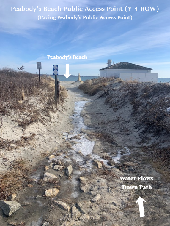
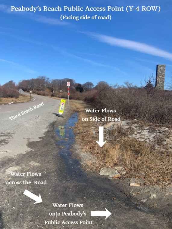
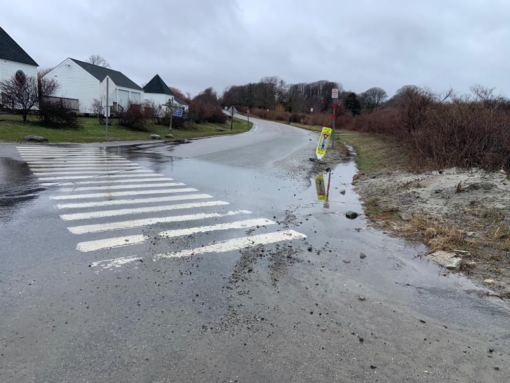
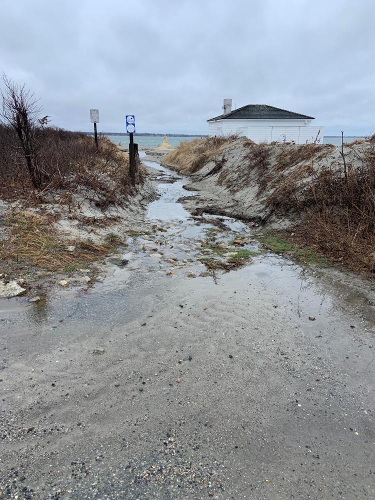
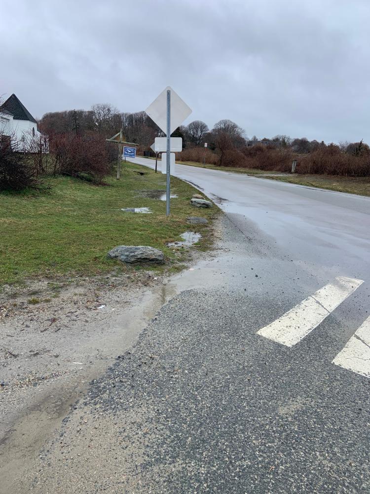
Site Description: This area often experiences flooding during heavy rainstorms. The water runs from the sides of streets (in some rain events across the street) and down the pedestrian trail leading to Peabody’s beach. Your uploaded videos and photos will assist with future planning for better stormwater management.
Photo-Video Tips: Take photos/videos while standing on the edge of the road of water pooling on sides of street, where the water crosses the road, and of water flowing down the Peabody beach’s pathway. Note: Stand safely on the side of flooding water, do not stand in the flood water and be cautious of vehicles/bikes/pedestrians.
Observation on 4/2/2026: 10:19am -
How recently did it rain: Raining at the time
How heavy was that rain: Light Shower
Is anything preventing water from flowing into the system (e.g., debris, trash, vegetation): Unknown
Is there standing water in the system: Yes
Observation on 3/6/2026: 12:20pm -
How recently did it rain: Raining at the time
How heavy was that rain: Light Shower
Is anything preventing water from flowing into the system (e.g., debris, trash, vegetation): Partially
Is there standing water in the system: Yes
Notes/Comments:
Run-off from overnight rain (approx. .5 – .75 inch) in addition to melting snowpack from blizzard on 23 Feb 2026; temp. about 36F