Location: 41.43906°N 71.47533°W
Get Directions
How recently did it rain: Raining at the time
How heavy was that rain: Heavy Rain
Is anything preventing water from flowing into the system (e.g., debris, trash, vegetation): Yes
Is there standing water in the system: No
Notes/Comments:
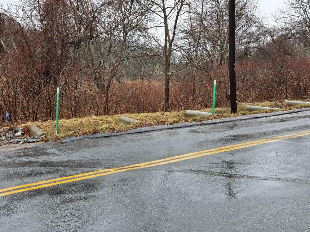
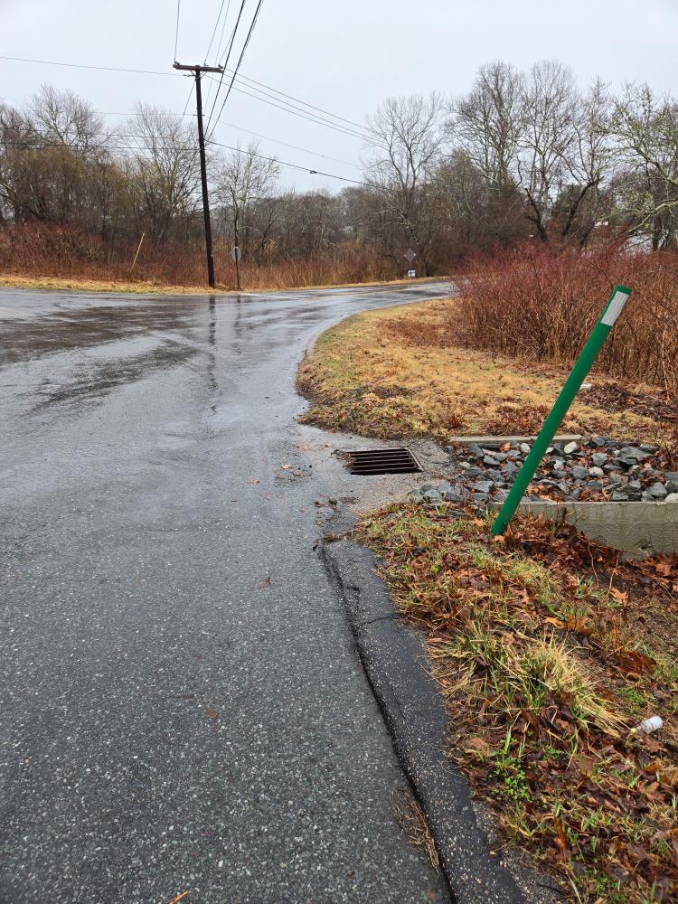
Blockage at the top causing water to run down the street instead of the swale. This site is adjacent to Mumford Brook – the Brook was flooding part of the lower part of the street just out of view of these shots. I am sending the video to the Rain Snap Admin as I was having difficulty uploading it.
Images and Videos
Weather Data
Precipitation Data from nearby CoCoRaHS stations:
| 3/16/2025 | 0.00” at station: RI-WS-81 (1.67 miles W) | 0.02” at station: RI-WS-106 (2.17 miles W) | 0.00” at station: RI-WS-65 (2.36 miles W) |
| 3/17/2025 | 1.53” at station: RI-WS-81 (1.67 miles W) | 2.03” at station: RI-WS-83 (1.73 miles NW) | 1.85” at station: RI-WS-70 (1.98 miles N) |
Note: CoCoRaHS data is usually collected between 6 and 8am so data listed as being from a given day are actually from 6 to 8am on that day through to 6 to 8am on the following day. Also, stations do not necessarily report every day so a station that has data on one date may not on another.
Precipitation Data from T.F.Green Airport (20.24 miles N)
Rainfall in the hour ending at the time listed.
| 3/16/2025 | 3/17/2025 | |
| 1am | 0” | 0.039” |
| 2am | 0” | 0.051” |
| 3am | 0” | 0.201” |
| 4am | 0” | 0.469” |
| 5am | 0” | 0.339” |
| 6am | 0” | 0.13” |
| 7am | 0” | 0.091” |
| 8am | 0” | 0.031” |
| 9am | 0” | 0.142” |
| 10am | 0” | 0.201” |
| 11am | 0” | 0.161” |
| 12am | 0” | 0.039” |
| 1pm | 0” | 0.02” |
| 2pm | 0” | |
| 3pm | 0” | |
| 4pm | 0” | |
| 5pm | 0” | |
| 6pm | 0” | |
| 7pm | 0” | |
| 8pm | 0” | |
| 9pm | 0” | |
| 10pm | 0” | |
| 11pm | 0” | |
| 12pm | 0.039 | |