Location: 41.501778°N 71.44756°W
Get Directions
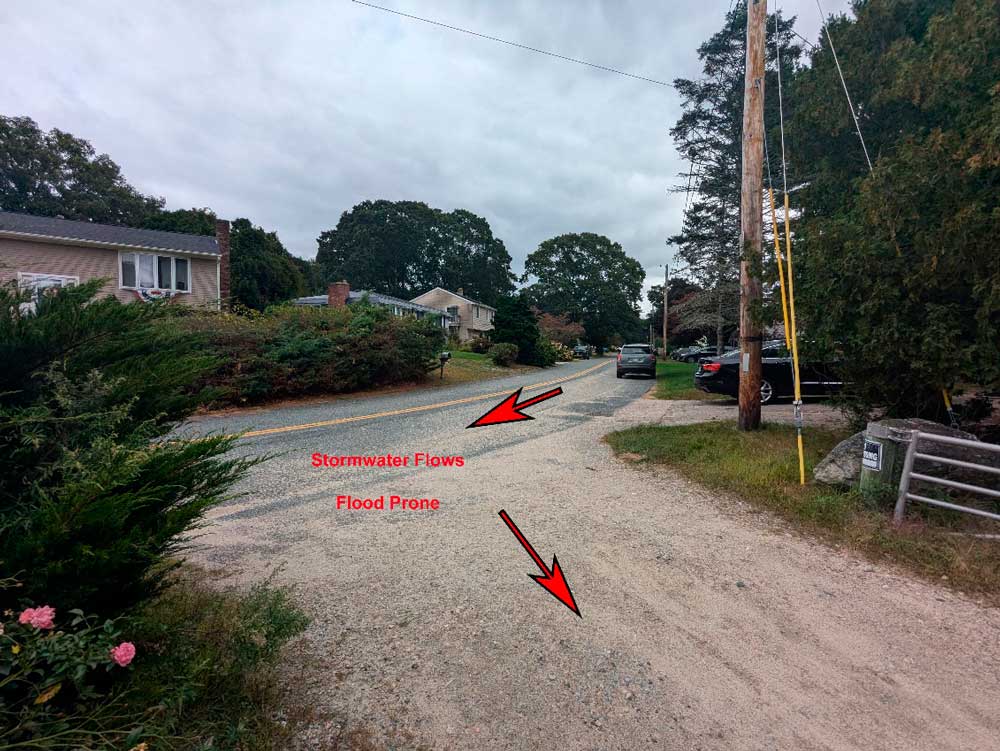
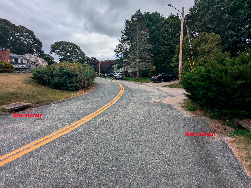
Site Description: This site is located in the Indian Trail neighborhood in northern Narragansett. The neighborhood is located on the eastern side of the Narrow River. This area often experiences flooding during heavy rainstorms and stormwater flows directly into the Narrow River. The storm drains here can get clogged, or the amount of rain might be more than the system can handle during intense storms. Your uploaded videos and photos will assist with both current maintenance efforts and provide valuable information for planners, engineers, and contractors as they develop future designs and plans.
Photo-Video Tips: To document the stormwater flow, stand near the entrance to the beach parking lot. With your phone, capture footage of stormwater running down the roadway from both Indian Trail and Bow Run. Make sure to document any stormwater bypassing the existing storm drains, and if the flow is large enough, check if it’s entering the parking lot and moving toward the beach.
Observation on 6/7/2025: 8:10pm -
How recently did it rain: Within the last hour
How heavy was that rain: Light Shower
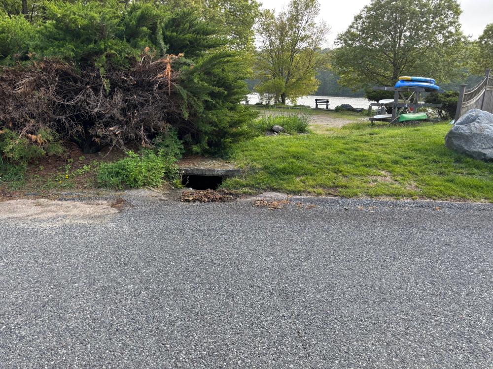
Is anything preventing water from flowing into the system (e.g., debris, trash, vegetation): Partially
Is there standing water in the system: Unknown
Observation on 5/22/2025: 5:00pm -
How recently did it rain: Raining at the time
How heavy was that rain: Moderate Rain
Is anything preventing water from flowing into the system (e.g., debris, trash, vegetation): Partially
Is there standing water in the system: Unknown
Observation on 5/14/2025: 5:00pm -
How recently did it rain: Within the last hour
How heavy was that rain: Light Shower
Is anything preventing water from flowing into the system (e.g., debris, trash, vegetation): No
Is there standing water in the system: No
Observation on 5/6/2025: 2:00pm -
How recently did it rain: Raining at the time
How heavy was that rain: Light Shower
Is anything preventing water from flowing into the system (e.g., debris, trash, vegetation): Unknown
Is there standing water in the system: Yes
Observation on 4/26/2025: 12:24pm -
How recently did it rain: Raining at the time
How heavy was that rain: Moderate Rain
Is anything preventing water from flowing into the system (e.g., debris, trash, vegetation): Partially
Is there standing water in the system: No
Notes/Comments:
rain started at 0528. heavy downpours start at 0938. a bit of debris at storm drain not blocking flow of water. No water running into parking lot